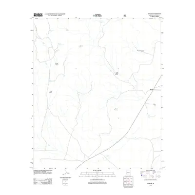
2012 Map of Apache
USGS Topo · Published 2012About this map
Apache occupies a significant position in the Peloncillo Mountains foothills, where the intersection of Skeleton Canyon Rd and the main highway marks a historically vital corridor in Cochise County. The landscape is defined by its water management systems, essential for cattle and local survival, featuring numerous named catchments such as IV Bar Tank, Horse Pasture Tank, and the Warner Storage Tank. These features, alongside the Apache Cem, point to a long-established ranching presence in this arid valley.
Find a feature on this map
20 named features on this map. Tap any name to fly to it.
Don’t see what you’re looking for? This feature index may not catch every label — zoom into the map to look around manually.
Map Details
Editions of this 2012 Apache Map
This is the sole edition of this map. No revisions or reprints were ever made.
Other maps of this area

1917 · Chiricahua
USGS Topo · 1:125,000

1919 · Chiricahua
USGS Topo · 1:125,000

1926 · Rodeo
USGS Topo · 1:62,500

1926 · Rucker
USGS Topo · 1:62,500

1926 · Pedregosa
USGS Topo · 1:62,500

1940 · Apache
USGS Topo · 1:62,500

1955 · Douglas
USGS Topo · 1:250,000

1958 · Chiricahua Peak
USGS Topo · 1:62,500

1958 · Apache
USGS Topo · 1:62,500
1958 · Pedregosa Mountains
USGS Topo · 1:62,500