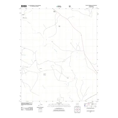
2011 Map of Apache Springs
USGS Topo · Published 2011About this map
Apache Springs and the surrounding high desert terrain define this corner of San Miguel County in the early 21st century. The landscape is marked by substantial geographic formations such as Middle Mesa and the aptly named Mesita de los Ladrones, which rise above the winding paths of Tecolote Creek and Arroyo Leguino. These waterways and their seasonal drainage patterns, including the deep Tres Hermanos Cañon and Cañada Ancha, have historically dictated the placement of small rural outposts and ranches.
Find a feature on this map
15 named features on this map. Tap any name to fly to it.
Don’t see what you’re looking for? This feature index may not catch every label — zoom into the map to look around manually.
Map Details
Editions of this 2011 Apache Springs Map
This is the sole edition of this map. No revisions or reprints were ever made.
Other maps of this area

1890 · Bernal
USGS Topo · 1:125,000

1891 · Bernal
USGS Topo · 1:125,000

1894 · Bernal
USGS Topo · 1:125,000

1954 · Santa Fe
USGS Topo · 1:250,000

1958 · Santa Fe
USGS Topo · 1:250,000

1960 · Villanueva
USGS Topo · 1:62,500

1960 · Apache Springs
USGS Topo · 1:62,500
1963 · Anton Chico
USGS Topo · 1:24,000
1963 · Dilia
USGS Topo · 1:24,000
1963 · San Juan
USGS Topo · 1:24,000