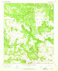
1963 Map of San Juan
USGS Topo · Published 1966About this map
The Pecos River carves through the northeastern corner of this high-desert landscape, where the Santa Fe National Forest meets the rugged breaks of La Cabra Mesa. During the early 1960s, the region was defined by a sparse network of traditional Hispanic settlements and family ranching operations. Significant landmarks include the village of San Juan, the small community of El Cerrito Santa Cruz, and scattered ranchsteads such as Romero Ranch and Quintana Ranch. The topography is dominated by an intricate system of deep canyons and mesas, including Cañon de los Maderos and Mesa Segura. Local social and spiritual life is anchored by landmarks like Dahlia Ch and various cemeteries, while the placement of La Gotera Well underscores the critical importance of water management in this arid territory.
Find a feature on this map
46 named features on this map. Tap any name to fly to it.
Don’t see what you’re looking for? This feature index may not catch every label — zoom into the map to look around manually.
Map Details
Editions of this 1963 San Juan Map
2 editions found
Other maps of this area

1890 · Bernal
USGS Topo · 1:125,000

1891 · Bernal
USGS Topo · 1:125,000

1894 · Bernal
USGS Topo · 1:125,000

1954 · Santa Fe
USGS Topo · 1:250,000

1958 · Santa Fe
USGS Topo · 1:250,000

1960 · Villanueva
USGS Topo · 1:62,500

1960 · Apache Springs
USGS Topo · 1:62,500

1963 · Jacinto Mesa
USGS Topo · 1:24,000
1963 · Anton Chico
USGS Topo · 1:24,000
1963 · Mesa Palo Amarillo
USGS Topo · 1:24,000