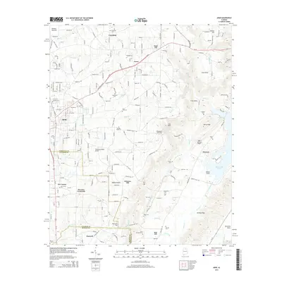
2014 Map of Arab
USGS Topo · Published 2014About this map
Brindley Mountain defines the northwest corner of this portrait, where the Tennessee Valley Divide snakes across the landscape near the meeting point of Marshall, Cullman, and Blount counties. This area shows the growth of Arab along Us-231 and Al-69, while preserving the footprints of long-established rural communities. To the southeast, the terrain drops toward Browns Valley and the inlet of Guntersville Lake. Genealogy and local history are anchored by numerous burial sites, from the Arab City Cem to the isolated Griffin Cem on Ben Johnson Ridge. The road network connects historic points such as Thrasher Crossroads and Johnsons Mill, illustrating the transition from agricultural outposts like Askea Grove and Scant City to the more developed corridors of the early 21st century.
Find a feature on this map
67 named features on this map. Tap any name to fly to it.
Don’t see what you’re looking for? This feature index may not catch every label — zoom into the map to look around manually.
Map Details
Editions of this 2014 Arab Map
This is the sole edition of this map. No revisions or reprints were ever made.
Other maps of this area

1885 · Gadsden
USGS Topo · 1:125,000

1888 · Cullman
USGS Topo · 1:125,000

1888 · Gadsden
USGS Topo · 1:125,000

1892 · Cullman
USGS Topo · 1:125,000

1892 · Gadsden
USGS Topo · 1:125,000

1895 · Gadsden
USGS Topo · 1:125,000

1903 · Gadsden
USGS Topo · 1:125,000

1936 · Guntersville
USGS Topo · 1:24,000

1936 · Guntersville Dam
USGS Topo · 1:24,000

1936 · Hulaco
USGS Topo · 1:24,000