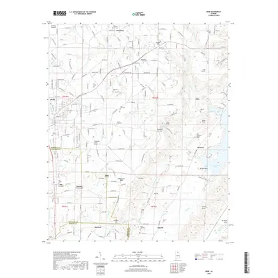
2018 Map of Arab
USGS Topo · Published 2018About this map
Brindley Mountain and the Tennessee Valley Divide dominate the topography of this Marshall County region, where the landscape transitions from highland ridges toward the waters of Guntersville Lake. The map details a network of rural communities such as Scant City, Friendship, and Hopewell, connected by winding roads through gaps like Thompson Falls Gap and Feemster Gap. Numerous burial sites, including New Canaan Cem and Berry-Brookshire Cem, are scattered across the terrain, reflecting the long-standing settlement of families in the area. The presence of Johnsons Mill on Warrior Cr and Thrasher Crossroads further illustrates the historic local economy and transport patterns. To the east, the terrain drops toward the Browns Valley Creek and Big Spring Valley, providing a clear view of the natural drainage systems that define the northern Alabama interior.
Find a feature on this map
225 named features on this map. Tap any name to fly to it.
Don’t see what you’re looking for? This feature index may not catch every label — zoom into the map to look around manually.
Map Details
Editions of this 2018 Arab Map
This is the sole edition of this map. No revisions or reprints were ever made.
Other maps of this area

1885 · Gadsden
USGS Topo · 1:125,000

1888 · Cullman
USGS Topo · 1:125,000

1888 · Gadsden
USGS Topo · 1:125,000

1892 · Cullman
USGS Topo · 1:125,000

1892 · Gadsden
USGS Topo · 1:125,000

1895 · Gadsden
USGS Topo · 1:125,000

1903 · Gadsden
USGS Topo · 1:125,000

1936 · Guntersville
USGS Topo · 1:24,000

1936 · Guntersville Dam
USGS Topo · 1:24,000

1936 · Hulaco
USGS Topo · 1:24,000