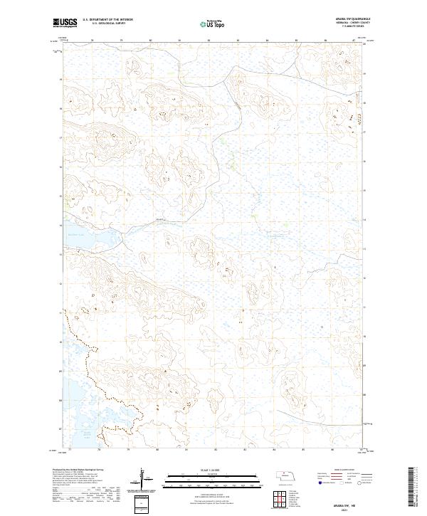
2021 Map of Arabia SW
USGS Topo · Published 2021About this map
Red Deer Lake and the wetlands of the Nebraska Sandhills define this landscape in Cherry County. This modern survey tracks the meandering path of the North Fork Plum Creek as it flows eastward through the high plains. The terrain is characterized by a high concentration of ephemeral and permanent water bodies, including South Marsh Lake in the southern reaches. Human presence is minimal in this portion of the interior, with only isolated transit routes like Red Deer Rd cutting through the complex system of dunes and basins. The map provides a precise record of the Public Land Survey System township and range lines, which remain the primary framework for land ownership and cattle ranching in this sparsely populated region.
Find a feature on this map
12 named features on this map. Tap any name to fly to it.
Don’t see what you’re looking for? This feature index may not catch every label — zoom into the map to look around manually.
Map Details
Editions of this 2021 Arabia SW Map
This is the sole edition of this map. No revisions or reprints were ever made.
Other maps of this area

1949 · Long Lake
USGS Topo · 1:62,500

1950 · Simeon
USGS Topo · 1:62,500

1950 · Arabia
USGS Topo · 1:62,500

1951 · Long Lake
USGS Topo · 1:62,500

1951 · Brownlee
USGS Topo · 1:62,500

1957 · Valentine
USGS Topo · 1:250,000

1959 · Valentine
USGS Topo · 1:250,000

1985 · Long Lake
USGS Topo · 1:24,000

1985 · Wilson Valley
USGS Topo · 1:24,000
1985 · Arabia SE
USGS Topo · 1:24,000