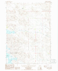
1985 Map of Arabia SW
USGS Topo · Published 1985About this map
The Valentine National Wildlife Refuge dominates the southern landscape of this Nebraska Sandhills region, preserving a critical network of wetlands and lakes. Large water bodies including Middle Marsh Lake and South Marsh Lake provide a distinct contrast to the surrounding dune topography. This 1985 provisional edition illustrates the sparse settlement pattern of Cherry County, where land use is defined by isolated outposts such as Rolling Stone Ranch and Red Deer Ranch.
Find a feature on this map
8 named features on this map. Tap any name to fly to it.
Don’t see what you’re looking for? This feature index may not catch every label — zoom into the map to look around manually.
Map Details
Editions of this 1985 Arabia SW Map
This is the sole edition of this map. No revisions or reprints were ever made.
Other maps of this area

1949 · Long Lake
USGS Topo · 1:62,500

1950 · Simeon
USGS Topo · 1:62,500

1950 · Arabia
USGS Topo · 1:62,500

1951 · Long Lake
USGS Topo · 1:62,500

1951 · Brownlee
USGS Topo · 1:62,500

1957 · Valentine
USGS Topo · 1:250,000

1959 · Valentine
USGS Topo · 1:250,000

1985 · Long Lake
USGS Topo · 1:24,000

1985 · Wilson Valley
USGS Topo · 1:24,000
1985 · Arabia SE
USGS Topo · 1:24,000