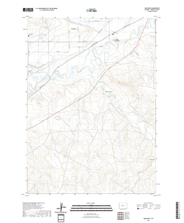
2021 Map of Arapahoe
USGS Topo · Published 2021About this map
The Little Wind River and its confluence with the Popo Agie River define this Fremont County landscape, where the settlements of Arapahoe and Saint Stephens anchor the local community. The mapping reveals a complex network of historic irrigation infrastructure essential to the region, including the Lefthand Ditch, Sub-Agency Ditch, and Mission Ditch. These waterways weave through a grid of rural roads such as 17 Mile Rd and Rendezvous Rd, illustrating the intersection of natural river systems and managed water resources.
Find a feature on this map
38 named features on this map. Tap any name to fly to it.
Don’t see what you’re looking for? This feature index may not catch every label — zoom into the map to look around manually.
Map Details
Editions of this 2021 Arapahoe Map
This is the sole edition of this map. No revisions or reprints were ever made.
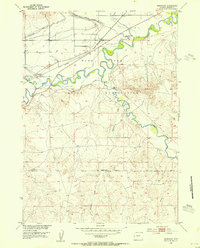
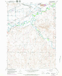
Historical Maps of Arapahoe Through Time
3 maps found