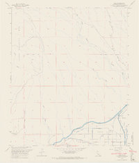
1964 Map of Araz
USGS Topo · Published 1966About this map
The Fort Yuma Indian Reservation dominates the southern landscape of this mid-1960s survey, defined by a dense network of irrigation laterals and canals. The engineering of the All American Canal and the Yuma Main Canal transformed this arid region, supported by infrastructure like the Pilot Knob Substation and several Gaging Stations. Evidence of earlier eras remains in the Old Indian Treaty Boundary cutting across the desert floor and the identified Araz (Site) near the Southern Pacific railroad tracks.
Find a feature on this map
25 named features on this map. Tap any name to fly to it.
Don’t see what you’re looking for? This feature index may not catch every label — zoom into the map to look around manually.
Map Details
Editions of this 1964 Araz Map
4 editions found
Other maps of this area

1903 · Yuma
USGS Topo · 1:125,000

1905 · Yuma
USGS Topo · 1:125,000

1940 · Yuma
USGS Topo · 1:62,500

1942 · Yuma
USGS Topo · 1:250,000

1945 · Picacho Peak
USGS Topo · 1:62,500

1945 · Yuma
USGS Topo · 1:62,500

1951 · Picacho Peak
USGS Topo · 1:62,500

1952 · Araz
USGS Topo · 1:24,000

1952 · Yuma East
USGS Topo · 1:24,000

1952 · Yuma West
USGS Topo · 1:24,000