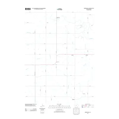
2013 Map of Arbor Hill
USGS Topo · Published 2013About this map
Arbor Hill and its surrounding agricultural townships appear in this topographic snapshot of central Adair County. The landscape is defined by the winding paths of the Middle River and Thompson River, which carve drainage patterns across a grid-based road system. Small settlements such as Stanzel, Nanito, and Hebron serve as local anchors along the rural corridors. A distinctive point of interest is the Millers Country Zoo, located near the intersection of Stuart Rd and 240th St. To the west, Henry A Wallace Dr pays tribute to the region's deep agricultural roots. Smaller waterways like Battle Cr and Marvel Cr indicate the varied topography that transitions from flat uplands to river-cut valleys. The map illustrates a contemporary rural Iowa structure, where historic place names persist alongside modern road designations and small-scale local enterprises.
Find a feature on this map
32 named features on this map. Tap any name to fly to it.
Don’t see what you’re looking for? This feature index may not catch every label — zoom into the map to look around manually.
Map Details
Editions of this 2013 Arbor Hill Map
This is the sole edition of this map. No revisions or reprints were ever made.
Other maps of this area

1951 · Afton
USGS Topo · 1:62,500

1952 · Winterset
USGS Topo · 1:62,500

1954 · Greenfield
USGS Topo · 1:62,500

1954 · Omaha
USGS Topo · 1:250,000

1957 · Omaha
USGS Topo · 1:250,000

1958 · Omaha
USGS Topo · 1:250,000

1981 · Zion
USGS Topo · 1:24,000
1981 · Orient
USGS Topo · 1:24,000
1983 · Rosserdale
USGS Topo · 1:24,000
1983 · Earlham West
USGS Topo · 1:24,000