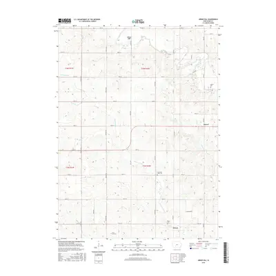
2015 Map of Arbor Hill
USGS Topo · Published 2015About this map
Hebron and Arbor Hill anchor this rural Adair County landscape, where the headwaters of the Thompson River and the Middle River carve a dissected drainage pattern through the Iowa plains. The settlement distribution follows a strict section-line grid, typical of the Midwestern prairie, with small communities like Stanzel located at key road intersections. Genealogists and local historians will find significant detail in the placement of small, rural burial grounds, including Boley Farm Cem, Roberts Cem, and the Grand River Center Cem. These sites, often located on higher ground overlooking watercourses like Battle Cr or Bush Br, provide a clear spatial record of early settlement families. The map also traces the transition of local commerce via routes like Co Rd P28 and Co Rd G53, which connect these isolated townships to the broader regional network of southwestern Iowa.
Find a feature on this map
38 named features on this map. Tap any name to fly to it.
Don’t see what you’re looking for? This feature index may not catch every label — zoom into the map to look around manually.
Map Details
Editions of this 2015 Arbor Hill Map
This is the sole edition of this map. No revisions or reprints were ever made.
Other maps of this area

1951 · Afton
USGS Topo · 1:62,500

1952 · Winterset
USGS Topo · 1:62,500

1954 · Greenfield
USGS Topo · 1:62,500

1954 · Omaha
USGS Topo · 1:250,000

1957 · Omaha
USGS Topo · 1:250,000

1958 · Omaha
USGS Topo · 1:250,000

1981 · Zion
USGS Topo · 1:24,000
1981 · Orient
USGS Topo · 1:24,000
1983 · Rosserdale
USGS Topo · 1:24,000
1983 · Earlham West
USGS Topo · 1:24,000