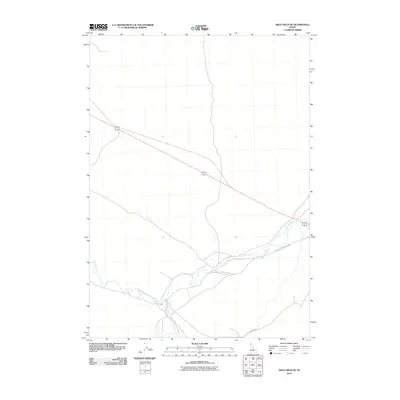
2010 Map of Arco Hills SE
USGS Topo · Published 2010About this map
The Big Lost River winds through this high desert terrain in south-central Idaho, creating a riparian corridor in an otherwise arid landscape. This 2010 survey shows the hydrological patterns of the river as it moves through the eastern Snake River Plain. The primary transportation artery through the area is the diagonal route of 20 26, which serves as a major connection point through the basalt-strewn plains. Local access is facilitated by primitive and secondary roads such as Big Southern Butte Rd and Adams Blvd, which provide pathways toward the prominent volcanic features located just beyond this quadrangle. The sparse infrastructure and lack of named settlements reflect the region's historical use for grazing and its proximity to federal scientific and desert land reserves.
Find a feature on this map
4 named features on this map. Tap any name to fly to it.
Don’t see what you’re looking for? This feature index may not catch every label — zoom into the map to look around manually.
Map Details
Editions of this 2010 Arco Hills SE Map
This is the sole edition of this map. No revisions or reprints were ever made.
Other maps of this area

1955 · Idaho Falls
USGS Topo · 1:250,000

1958 · Idaho Falls
USGS Topo · 1:250,000

1972 · Quaking Aspen Butte
USGS Topo · 1:24,000

1972 · Arco Hills SE
USGS Topo · 1:24,000

1972 · Big Southern Butte
USGS Topo · 1:24,000

1972 · Howe Peak
USGS Topo · 1:24,000

1972 · Butte City
USGS Topo · 1:24,000

1972 · Arco Hills
USGS Topo · 1:24,000

1973 · Scoville
USGS Topo · 1:24,000

1973 · Circular Butte 3 SW
USGS Topo · 1:24,000