
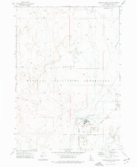
1972 Map of Arco Hills SE
USGS Topo · Published 1976About this map
The Idaho National Engineering Laboratory dominates the central landscape of this 1970s survey, marking a significant era of nuclear research in the high desert. Along its southern reaches, the Experimental Breeder Reactor No 1 stands as a landmark of atomic history, located near the junction of Van Buren Blvd. The presence of numerous Borrow Pits and a Drill Hole across the plain suggests the intensive construction and geological testing associated with the facility's development.
Find a feature on this map
11 named features on this map. Tap any name to fly to it.
Don’t see what you’re looking for? This feature index may not catch every label — zoom into the map to look around manually.
Map Details
Editions of this 1972 Arco Hills SE Map
This is the sole edition of this map. No revisions or reprints were ever made.
Other maps of this area

1955 · Idaho Falls
USGS Topo · 1:250,000

1958 · Idaho Falls
USGS Topo · 1:250,000

1972 · Quaking Aspen Butte
USGS Topo · 1:24,000

1972 · Big Southern Butte
USGS Topo · 1:24,000

1972 · Howe Peak
USGS Topo · 1:24,000

1972 · Butte City
USGS Topo · 1:24,000

1972 · Arco Hills
USGS Topo · 1:24,000

1973 · Scoville
USGS Topo · 1:24,000

1973 · Circular Butte 3 SW
USGS Topo · 1:24,000
1973 · Circular Butte 3 NW
USGS Topo · 1:24,000