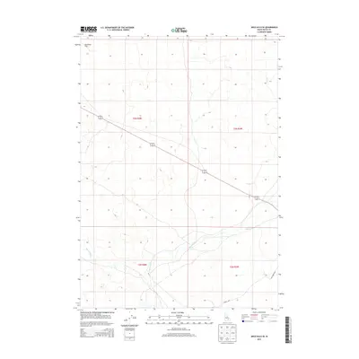
2013 Map of Arco Hills SE
USGS Topo · Published 2013About this map
Big Lost River winds through the southern portion of this landscape, marking a vital hydrological feature in a high-desert environment. The northern reaches are dominated by the expanse of Deadman Flat, where the terrain begins to transition toward the foot of the hills. This 2013 survey illustrates the sparse, regulated nature of the land, defined by a rigid grid of section lines and the occasional diagonal path of modern infrastructure. Local transit is concentrated along named thoroughfares like Adams Blvd and Van Buren Blvd, which provide access to the surveyed plots of land in t3n r28e and surrounding townships. The map serves as a detailed record of the contemporary land-management patterns and the persistence of traditional Western place names across the Snake River Plain transition zone.
Find a feature on this map
8 named features on this map. Tap any name to fly to it.
Don’t see what you’re looking for? This feature index may not catch every label — zoom into the map to look around manually.
Map Details
Editions of this 2013 Arco Hills SE Map
This is the sole edition of this map. No revisions or reprints were ever made.
Other maps of this area

1955 · Idaho Falls
USGS Topo · 1:250,000

1958 · Idaho Falls
USGS Topo · 1:250,000

1972 · Quaking Aspen Butte
USGS Topo · 1:24,000

1972 · Arco Hills SE
USGS Topo · 1:24,000

1972 · Big Southern Butte
USGS Topo · 1:24,000

1972 · Howe Peak
USGS Topo · 1:24,000

1972 · Butte City
USGS Topo · 1:24,000

1972 · Arco Hills
USGS Topo · 1:24,000

1973 · Scoville
USGS Topo · 1:24,000

1973 · Circular Butte 3 SW
USGS Topo · 1:24,000