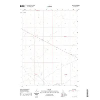
2020 Map of Arco Hills SE
USGS Topo · Published 2020About this map
Big Lost River winds through the southern portion of this high desert landscape, carving a path through the arid terrain of Butte County. The area is characterized by the expansive Deadman Flat to the northwest, a region defined by its wide, open topography and distinct lack of dense settlement. A primary transportation artery, Highway 20/26, cuts diagonally across the quadrangle, serving as the main connection across this remote stretch of Idaho. The map reveals the intricate Public Land Survey System grid, with several township and range boundaries such as t3n r28e and t2n r29e providing a structural framework for this sparsely populated territory where the natural hydrology of the river remains the most prominent geographic feature.
Find a feature on this map
8 named features on this map. Tap any name to fly to it.
Don’t see what you’re looking for? This feature index may not catch every label — zoom into the map to look around manually.
Map Details
Editions of this 2020 Arco Hills SE Map
This is the sole edition of this map. No revisions or reprints were ever made.
Other maps of this area

1955 · Idaho Falls
USGS Topo · 1:250,000

1958 · Idaho Falls
USGS Topo · 1:250,000

1972 · Quaking Aspen Butte
USGS Topo · 1:24,000

1972 · Arco Hills SE
USGS Topo · 1:24,000

1972 · Big Southern Butte
USGS Topo · 1:24,000

1972 · Howe Peak
USGS Topo · 1:24,000

1972 · Butte City
USGS Topo · 1:24,000

1972 · Arco Hills
USGS Topo · 1:24,000

1973 · Scoville
USGS Topo · 1:24,000

1973 · Circular Butte 3 SW
USGS Topo · 1:24,000