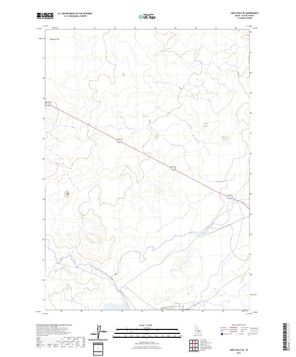
2023 Map of Arco Hills SE
USGS Topo · Published 2023About this map
Big Lost River meanders through the southern portion of this landscape, its path cutting across the township lines of Butte County. The terrain is defined by the broad expanse of Deadman Flat to the northwest, a stark contrast to the shifting elevations of the Arco Hills region. A straight transit corridor, marked as 20 26, bisects the area diagonally, serving as the primary infrastructure link through this high-desert environment. This 2023 survey provides a clear look at the intersection of natural water systems and public land survey boundaries, showing how the river’s erratic course interacts with the rigid grid of townships such as t3n r28e and t2n r29e.
Find a feature on this map
8 named features on this map. Tap any name to fly to it.
Don’t see what you’re looking for? This feature index may not catch every label — zoom into the map to look around manually.
Map Details
Editions of this 2023 Arco Hills SE Map
This is the sole edition of this map. No revisions or reprints were ever made.
Other maps of this area

1955 · Idaho Falls
USGS Topo · 1:250,000

1958 · Idaho Falls
USGS Topo · 1:250,000

1972 · Quaking Aspen Butte
USGS Topo · 1:24,000

1972 · Arco Hills SE
USGS Topo · 1:24,000

1972 · Big Southern Butte
USGS Topo · 1:24,000

1972 · Howe Peak
USGS Topo · 1:24,000

1972 · Butte City
USGS Topo · 1:24,000

1972 · Arco Hills
USGS Topo · 1:24,000

1973 · Scoville
USGS Topo · 1:24,000

1973 · Circular Butte 3 SW
USGS Topo · 1:24,000