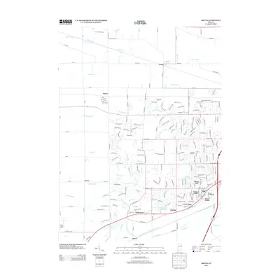
2013 Map of Arcola
USGS Topo · Published 2013About this map
Arcola serves as a central hub in this western Allen County landscape, situated near the intersection of Arcola Rd and Reed St. The terrain is defined by an extensive network of drainage systems, including the Graham McCulloch Ditch and Seegar Ditch, which manage the low-lying areas near the headwaters of the Little River. Suburban expansion is evident in the cluster of residential developments in the southeast, such as Liberty Hills and Rolling Hills, contrasted against the more traditional rural settlements of Dunfee and Saturn.
Find a feature on this map
52 named features on this map. Tap any name to fly to it.
Don’t see what you’re looking for? This feature index may not catch every label — zoom into the map to look around manually.
Map Details
Editions of this 2013 Arcola Map
This is the sole edition of this map. No revisions or reprints were ever made.
Other maps of this area

1953 · Fort Wayne
USGS Topo · 1:250,000

1953 · Muncie
USGS Topo · 1:250,000

1955 · Columbia City
USGS Topo · 1:24,000

1956 · Muncie
USGS Topo · 1:250,000

1956 · Fort Wayne
USGS Topo · 1:250,000

1956 · Fort Wayne West
USGS Topo · 1:24,000

1956 · Huntington
USGS Topo · 1:24,000

1957 · Huntertown
USGS Topo · 1:24,000

1957 · Churubusco
USGS Topo · 1:24,000

1961 · Arcola
USGS Topo · 1:24,000