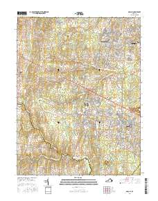
2016 Map of Arcola
USGS Topo · Published 2016About this map
Arcola and South Riding anchor this 2016 survey, which documents the suburban transformation of Loudoun County's landscape. The map details the transition from rural crossroads like Watson and Lenah to planned communities including Stone Ridge, Brambleton, and Loudoun Valley Estates. Despite the modern development, evidence of the area's deeper history remains, particularly along the Loudoun and Prince William County border. Genealogists can locate several family and local burial sites, such as Mount Zion Cem, Ish Family Cem, and Allen Cem, which stand as reminders of the agricultural past.
Find a feature on this map
211 named features on this map. Tap any name to fly to it.
Don’t see what you’re looking for? This feature index may not catch every label — zoom into the map to look around manually.
Map Details
Editions of this 2016 Arcola Map
This is the sole edition of this map. No revisions or reprints were ever made.
Other maps of this area

1884 · Harpers Ferry
USGS Topo · 1:125,000

1890 · Mt. Vernon
USGS Topo · 1:125,000

1891 · Harpers Ferry
USGS Topo · 1:125,000

1891 · Mt. Vernon
USGS Topo · 1:125,000

1893 · Frederick
USGS Topo · 1:125,000

1893 · Harpers Ferry
USGS Topo · 1:125,000

1894 · Warrenton
USGS Topo · 1:125,000

1894 · Frederick
USGS Topo · 1:125,000

1894 · Mt. Vernon
USGS Topo · 1:125,000

1897 · Mt. Vernon
USGS Topo · 1:125,000