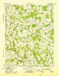
1944 Map of Arcola
USGS Topo · Published 1944About this map
Arcola and the surrounding Virginia countryside appear in this mid-century survey, defined by a network of rural crossroads and historic church sites. The Lee-Jackson Memorial Highway serves as the primary east-west artery, connecting small communities like Lenah and Watson. Local social life is anchored by institutions such as Watson-Sch and several houses of worship, including Mt Zion Ch, Little River Ch, and Conklin Ch. The landscape is etched by numerous watercourses, most notably Broad Run and Bull Run, which delineate the rolling terrain. The map also captures the political geography of the era, showing the converging boundaries of Loudoun County, Prince William County, and Loudoun Fairfax, providing a detailed look at the land before modern suburban expansion reshaped the region.
Find a feature on this map
21 named features on this map. Tap any name to fly to it.
Don’t see what you’re looking for? This feature index may not catch every label — zoom into the map to look around manually.
Map Details
Editions of this 1944 Arcola Map
This is the sole edition of this map. No revisions or reprints were ever made.
Other maps of this area

1884 · Harpers Ferry
USGS Topo · 1:125,000

1890 · Mt. Vernon
USGS Topo · 1:125,000

1891 · Harpers Ferry
USGS Topo · 1:125,000

1891 · Mt. Vernon
USGS Topo · 1:125,000

1893 · Frederick
USGS Topo · 1:125,000

1893 · Harpers Ferry
USGS Topo · 1:125,000

1894 · Warrenton
USGS Topo · 1:125,000

1894 · Frederick
USGS Topo · 1:125,000

1894 · Mt. Vernon
USGS Topo · 1:125,000

1897 · Mt. Vernon
USGS Topo · 1:125,000