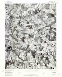
1977 Map of Arcola
USGS Topo · Published 1982About this map
Arcola and its neighboring rural crossroads define this 1977 orthophotoquad in Loudoun County, Virginia. This specialized photographic survey, produced by the Geological Survey in cooperation with the Soil Conservation Service, uses rectified imagery to show the land precisely as it appeared in the late 1970s. The landscape is a mosaic of active agricultural fields and woodlots, bisected by the watercourses of Broad Run, South Fork Broad Run, and Bull Run.
Find a feature on this map
8 named features on this map. Tap any name to fly to it.
Don’t see what you’re looking for? This feature index may not catch every label — zoom into the map to look around manually.
Map Details
Editions of this 1977 Arcola Map
This is the sole edition of this map. No revisions or reprints were ever made.
Other maps of this area

1884 · Harpers Ferry
USGS Topo · 1:125,000

1890 · Mt. Vernon
USGS Topo · 1:125,000

1891 · Harpers Ferry
USGS Topo · 1:125,000

1891 · Mt. Vernon
USGS Topo · 1:125,000

1893 · Frederick
USGS Topo · 1:125,000

1893 · Harpers Ferry
USGS Topo · 1:125,000

1894 · Warrenton
USGS Topo · 1:125,000

1894 · Frederick
USGS Topo · 1:125,000

1894 · Mt. Vernon
USGS Topo · 1:125,000

1897 · Mt. Vernon
USGS Topo · 1:125,000