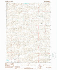
1989 Map of Argo Hill
USGS Topo · Published 1989About this map
Survey Valley and Wolford Valley dominate this pocket of the Nebraska Sandhills, where family ranching operations define the high-plains landscape. The map provides a detailed record of multi-generational landholdings, including the Dukat Ranch, T Strasburger Ranch, and several properties belonging to the Hamilton family such as the C Hamilton Ranch and N Hamilton Ranch. These named homesteads are situated amidst a series of prominent elevations like Argo Hill, Morton Hill, and Lloyd Hill.
Find a feature on this map
21 named features on this map. Tap any name to fly to it.
Don’t see what you’re looking for? This feature index may not catch every label — zoom into the map to look around manually.
Map Details
Editions of this 1989 Argo Hill Map
This is the sole edition of this map. No revisions or reprints were ever made.
Other maps of this area

1948 · Bingham
USGS Topo · 1:62,500

1948 · Lakeside
USGS Topo · 1:62,500

1948 · Twin Lakes
USGS Topo · 1:62,500

1948 · Spade Ranch
USGS Topo · 1:62,500

1950 · Twin Lakes
USGS Topo · 1:62,500

1950 · Spade Ranch
USGS Topo · 1:62,500

1950 · Lakeside
USGS Topo · 1:62,500

1950 · Bingham
USGS Topo · 1:62,500

1955 · Alliance
USGS Topo · 1:250,000

1957 · Alliance
USGS Topo · 1:250,000