
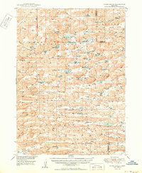
1950 Map of Spade Ranch
USGS Topo · Published 1950About this map
Spade Ranch anchors this high plains landscape in the Sandhills of western Nebraska, reflecting a mid-century era of remote cattle ranching and sparse rural settlement. The terrain is defined by a dense network of valleys and perched water bodies, including Smith Lake, Mother Lake, and the clusters of Osborne Lake and West Osborne Lake. This environment required a unique educational infrastructure to serve the widely dispersed population, evidenced by numerous numbered schoolhouses such as School No 134, School No 166, and School No 161. The naming conventions throughout Survey Valley and Wolford Valley point to early land divisions and the Kinkaid Act's influence on homesteading in the region. Notable landmarks like Argo Hill and Highland Flats provide relief against the broad valley floors where small hubs like Brighton once established a foothold in the ranching economy.
Find a feature on this map
51 named features on this map. Tap any name to fly to it.
Don’t see what you’re looking for? This feature index may not catch every label — zoom into the map to look around manually.
Map Details
Editions of this 1950 Spade Ranch Map
2 editions found
Other maps of this area

1948 · Ashby
USGS Topo · 1:62,500

1948 · Bingham
USGS Topo · 1:62,500

1948 · Lakeside
USGS Topo · 1:62,500

1948 · Twin Lakes
USGS Topo · 1:62,500

1948 · Spade Ranch
USGS Topo · 1:62,500

1949 · Ashby
USGS Topo · 1:62,500

1949 · Turpin Lake
USGS Topo · 1:62,500

1950 · Twin Lakes
USGS Topo · 1:62,500

1950 · Lakeside
USGS Topo · 1:62,500

1950 · Bingham
USGS Topo · 1:62,500