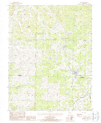
1987 Map of Argyle
USGS Topo · Published 1988About this map
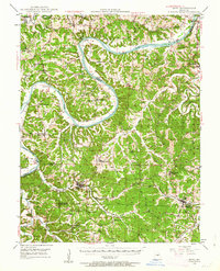
Argyle and Koeltztown anchor this rural landscape along the border of Osage Co Maries Co during the late 1980s. The terrain is defined by a dense network of drainages, including the winding path of Loose Creek and Little Maries Creek, which eventually gives way to the Little Maries River. These watercourses carve through the townships of Jackson, Boone, Washington, and Johnson, illustrating the persistent agricultural and small-settlement patterns of central Missouri.
Find a feature on this map
16 named features on this map. Tap any name to fly to it.
Don’t see what you’re looking for? This feature index may not catch every label — zoom into the map to look around manually.
Map Details
Editions of this 1987 Argyle Map
This is the sole edition of this map. No revisions or reprints were ever made.
Other maps of this area

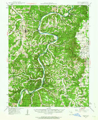
1888 · Tuscumbia
USGS Topo · 1:125,000

1894 · Tuscumbia
USGS Topo · 1:125,000

1934 · Linn
USGS Topo · 1:48,000
1937 · Vienna
USGS Topo · 1:62,500
1938 · Vienna
USGS Topo · 1:48,000
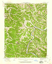
1942 · Linn
USGS Topo · 1:62,500

1945 · Linn
USGS Topo · 1:62,500

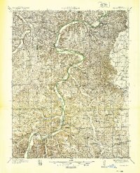
1947 · Jefferson City
USGS Topo · 1:250,000
1948 · Meta
USGS Topo · 1:62,500
1948 · Tavern
USGS Topo · 1:62,500