
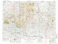
1955 Map of Arminto
USGS Topo · Published 1976About this map
The high plains of central Wyoming are defined here by a complex web of drainage basins and early petroleum development. The landscape is dominated by the sprawling Teapot Dome Naval Petroleum Reserve No 3, an area of significant historical and political weight. This energy-rich corridor is further marked by the Burlington Northern railroad, which traces a path through small railroad settlements like Arminto and Lysite before cutting across the Ralston Flats.
Find a feature on this map
75 named features on this map. Tap any name to fly to it.
Don’t see what you’re looking for? This feature index may not catch every label — zoom into the map to look around manually.
Map Details
Editions of this 1955 Arminto Map
2 editions found
Other maps of this area

1899 · Cloud peak
USGS Topo · 1:125,000

1900 · Fort McKinney
USGS Topo · 1:125,000

1901 · Cloud Peak
USGS Topo · 1:125,000

1903 · Fort McKinney
USGS Topo · 1:125,000

1945 · Kirby
USGS Topo · 1:62,500

1946 · Kirby
USGS Topo · 1:62,500

1949 · Campbell Hill
USGS Topo · 1:24,000

1949 · Glenrock NW
USGS Topo · 1:24,000

1949 · Pratts Soda Lakes
USGS Topo · 1:24,000

1950 · Campbell Hill
USGS Topo · 1:24,000