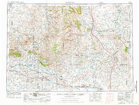
1955 Map of Arminto
USGS Topo · Published 1976About this map
The Bighorn Mountains dominate the northwestern horizon of this Central Wyoming survey, giving way to a high-desert landscape defined by complex water systems and energy production. The southern portion of the sheet highlights the transition from the Sand Hills into the ranching and railroad corridor served by the Burlington Northern line, connecting stops like Arminto and Petrie Siding.
Find a feature on this map
63 named features on this map. Tap any name to fly to it.
Don’t see what you’re looking for? This feature index may not catch every label — zoom into the map to look around manually.
Map Details
Editions of this 1955 Arminto Map
2 editions found

Other maps of this area

1899 · Cloud peak
USGS Topo · 1:125,000

1900 · Fort McKinney
USGS Topo · 1:125,000

1901 · Cloud Peak
USGS Topo · 1:125,000

1903 · Fort McKinney
USGS Topo · 1:125,000

1945 · Kirby
USGS Topo · 1:62,500

1946 · Kirby
USGS Topo · 1:62,500

1949 · Campbell Hill
USGS Topo · 1:24,000

1949 · Glenrock NW
USGS Topo · 1:24,000

1949 · Pratts Soda Lakes
USGS Topo · 1:24,000

1950 · Campbell Hill
USGS Topo · 1:24,000