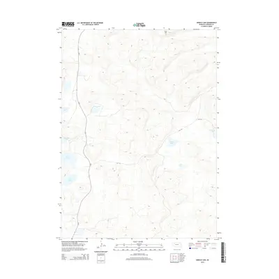
2014 Map of Arnold Lake
USGS Topo · Published 2014About this map
Wolf Hill stands as the primary elevation in this corner of Sheridan County, overlooking a landscape defined by isolated alkaline lakes and wetlands within the Nebraska Sandhills. These water bodies, including Arnold Lake, Wintermuth Lake, and Watson Lake, are dispersed across the undulating terrain, indicating the unique hydrology of the region where groundwater often meets the surface in interdunal swales. Transportation across this sparsely populated area is limited to a few arterial routes such as Ne-27 and local tracks like 241st Trl, which connect the scattered ranch lands. The proximity of Deer Lake and Granning Lake further emphasizes the wetland density that has historically influenced land use and grazing patterns in this part of the state.
Find a feature on this map
12 named features on this map. Tap any name to fly to it.
Don’t see what you’re looking for? This feature index may not catch every label — zoom into the map to look around manually.
Map Details
Editions of this 2014 Arnold Lake Map
This is the sole edition of this map. No revisions or reprints were ever made.
Other maps of this area

1948 · Bingham
USGS Topo · 1:62,500

1948 · Lakeside
USGS Topo · 1:62,500

1948 · Twin Lakes
USGS Topo · 1:62,500

1948 · Spade Ranch
USGS Topo · 1:62,500

1950 · Twin Lakes
USGS Topo · 1:62,500

1950 · Spade Ranch
USGS Topo · 1:62,500

1950 · Lakeside
USGS Topo · 1:62,500

1950 · Bingham
USGS Topo · 1:62,500

1955 · Alliance
USGS Topo · 1:250,000

1957 · Alliance
USGS Topo · 1:250,000