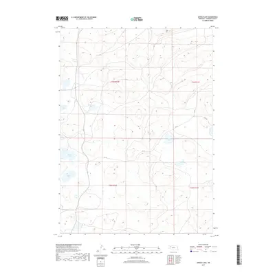
2017 Map of Arnold Lake
USGS Topo · Published 2017About this map
Arnold Lake and a series of smaller depressions characterize this pocket of Sheridan County, where the high plains landscape is dotted with naturally occurring water bodies. The geography is defined by a succession of basins, including Wintermuth Lake, Carnes Lake, and Walters Lake, which likely serve as critical seasonal water sources in this semi-arid region. Wolf Hill stands as one of the few named topographic landmarks, providing a vantage point over the section lines and township boundaries of T26N and T25N. Apart from a few unpaved routes like 241 Trl and 277 Trl, the area remains largely undeveloped, showcasing the original Public Land Survey System grid that organized Nebraska’s ranching country.
Find a feature on this map
13 named features on this map. Tap any name to fly to it.
Don’t see what you’re looking for? This feature index may not catch every label — zoom into the map to look around manually.
Map Details
Editions of this 2017 Arnold Lake Map
This is the sole edition of this map. No revisions or reprints were ever made.
Other maps of this area

1948 · Bingham
USGS Topo · 1:62,500

1948 · Lakeside
USGS Topo · 1:62,500

1948 · Twin Lakes
USGS Topo · 1:62,500

1948 · Spade Ranch
USGS Topo · 1:62,500

1950 · Twin Lakes
USGS Topo · 1:62,500

1950 · Spade Ranch
USGS Topo · 1:62,500

1950 · Lakeside
USGS Topo · 1:62,500

1950 · Bingham
USGS Topo · 1:62,500

1955 · Alliance
USGS Topo · 1:250,000

1957 · Alliance
USGS Topo · 1:250,000