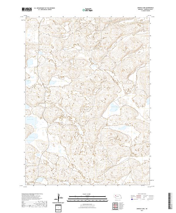
2021 Map of Arnold Lake
USGS Topo · Published 2021About this map
Sheridan County's iconic Sandhills topography is on full display in this modern survey of the Arnold Lake quadrangle. This interior region of Nebraska is characterized by a high concentration of depression-fed water bodies, most notably Arnold Lake and Walters Lake in the southwest, and the isolated Deer Lake to the east. These lakes, often situated in low basins between wind-sculpted hills, represent the critical hydrology of the high plains. A prominent high point at Wolf Hill provides a vantage over the surrounding dunes and blowouts. The human presence is light and largely defined by primitive transit routes such as 241 Trl and 277 Trl, which navigate the terrain between grazing lands and water sources. This map serves as a contemporary record of a landscape that remains largely unchanged in its fundamental character, preserving the names of local landmarks like Carnes Lake and Watson Lake.
Find a feature on this map
12 named features on this map. Tap any name to fly to it.
Don’t see what you’re looking for? This feature index may not catch every label — zoom into the map to look around manually.
Map Details
Editions of this 2021 Arnold Lake Map
This is the sole edition of this map. No revisions or reprints were ever made.
Other maps of this area

1948 · Bingham
USGS Topo · 1:62,500

1948 · Lakeside
USGS Topo · 1:62,500

1948 · Twin Lakes
USGS Topo · 1:62,500

1948 · Spade Ranch
USGS Topo · 1:62,500

1950 · Twin Lakes
USGS Topo · 1:62,500

1950 · Spade Ranch
USGS Topo · 1:62,500

1950 · Lakeside
USGS Topo · 1:62,500

1950 · Bingham
USGS Topo · 1:62,500

1955 · Alliance
USGS Topo · 1:250,000

1957 · Alliance
USGS Topo · 1:250,000