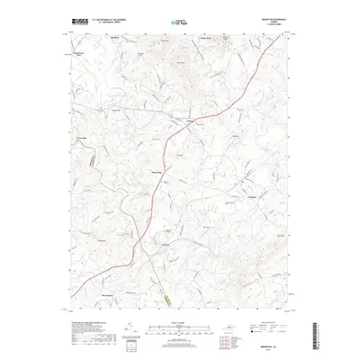
2019 Map of Arrington
USGS Topo · Published 2019About this map
The Tye River winds through this Central Virginia landscape, carving a path between the foothills of the Blue Ridge. The settlement of Arrington serves as a local focal point near the eastern edge of the map, while Colleen and Kingswood occupy the central corridor along the main thoroughfare. This area is characterized by several small local airfields, including Flatwoods Airport, Tye River Airport, and Starr Airport, which suggest a reliance on light aviation for regional connectivity. Family history and local heritage are preserved at the White Rock Cem and Woodland Cem. The terrain is marked by distinctive elevations like Cabell Mtn and Crits Mtn, with the county line between Amherst and Nelson counties cutting through the southwestern portion near New Glasgow.
Find a feature on this map
119 named features on this map. Tap any name to fly to it.
Don’t see what you’re looking for? This feature index may not catch every label — zoom into the map to look around manually.
Map Details
Editions of this 2019 Arrington Map
This is the sole edition of this map. No revisions or reprints were ever made.
Other maps of this area

1892 · Buckingham
USGS Topo · 1:125,000

1894 · Lexington
USGS Topo · 1:125,000

1935 · Amherst
USGS Topo · 1:48,000

1936 · Vesuvius
USGS Topo · 1:48,000

1939 · Amherst
USGS Topo · 1:62,500

1941 · Vesuvius
USGS Topo · 1:62,500

1943 · Lovingston
USGS Topo · 1:62,500

1946 · Lovingston
USGS Topo · 1:62,500

1947 · Roanoke
USGS Topo · 1:250,000

1950 · Amherst
USGS Topo · 1:62,500