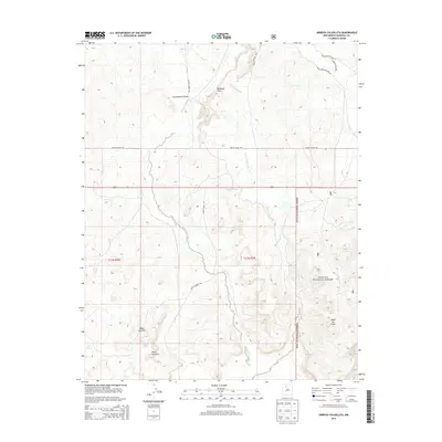
2013 Map of Arroyo Chijuillita
USGS Topo · Published 2013About this map
The Continental Divide winds through this high-desert landscape in Sandoval County, defining the drainage patterns of the western slope. The topography is dominated by the prominent Mesa Chijuilla and Mesa de Cuba, with the namesake Arroyo Chijuillita carving a path through the central valley. This 2013 survey illustrates the intersection of several administrative boundaries, including the southern edge of the Apache Indian Res and the western reaches of the Santa Fe National Forest. Human passage through these Badland Hills is marked by a network of specialized thoroughfares, such as Indian Service Route 22 and Chuilla Road 1101, which connect remote watering points like Champe Tank and Pine Spring. The map provides a precise record of these isolated landmarks and the complex terrain of the New Mexico backcountry.
Find a feature on this map
14 named features on this map. Tap any name to fly to it.
Don’t see what you’re looking for? This feature index may not catch every label — zoom into the map to look around manually.
Map Details
Editions of this 2013 Arroyo Chijuillita Map
This is the sole edition of this map. No revisions or reprints were ever made.
Other maps of this area

1883 · Mt. Taylor
USGS Topo · 1:250,000

1886 · Mt. Taylor
USGS Topo · 1:250,000

1889 · Largo
USGS Topo · 1:250,000

1890 · Jemes
USGS Topo · 1:125,000

1892 · Jemes
USGS Topo · 1:125,000

1892 · Mt. Taylor
USGS Topo · 1:250,000

1895 · Largo
USGS Topo · 1:250,000

1899 · Mt. Taylor
USGS Topo · 1:250,000

1909 · Gallina
USGS Topo · 1:125,000

1939 · La Ventana
USGS Topo · 1:62,500