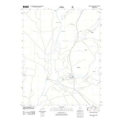
2011 Map of Arroyo Hondo
USGS Topo · Published 2011About this map
Arroyo Hondo serves as a focal point for this Taos County landscape, situated where the Rio Hondo meets the dramatic corridor of the Rio Grande Wild River. The map illustrates a complex network of traditional water management and modern development, featuring the Acequia de Atalaya and the Llano Ditch, which trace the irrigation history of the high desert. To the north, the settlement of San Cristobal is tucked near the Sangre de Cristo Mountains, while the New Buffalo Area sits along the southern hills. Local heritage is preserved at the Rael Cemetery, and the presence of the Arroyo Hondo Post Office and San Cristobal Post Office marks the continued civic life of these mountain communities. The terrain is further defined by deep carvings like Garrapata Canyon and prominent peaks such as Cerro Negro.
Find a feature on this map
41 named features on this map. Tap any name to fly to it.
Don’t see what you’re looking for? This feature index may not catch every label — zoom into the map to look around manually.
Map Details
Editions of this 2011 Arroyo Hondo Map
This is the sole edition of this map. No revisions or reprints were ever made.
Other maps of this area

1954 · Raton
USGS Topo · 1:250,000

1958 · Raton
USGS Topo · 1:250,000

1961 · Tres Orejas
USGS Topo · 1:24,000

1963 · Arroyo Seco
USGS Topo · 1:24,000

1963 · Arroyo Hondo
USGS Topo · 1:24,000

1963 · Tres Piedras NE
USGS Topo · 1:24,000

1963 · Cerro De Los Taoses
USGS Topo · 1:24,000

1963 · Questa
USGS Topo · 1:24,000

1963 · Guadalupe Mountain
USGS Topo · 1:24,000

1964 · Los Cordovas
USGS Topo · 1:24,000