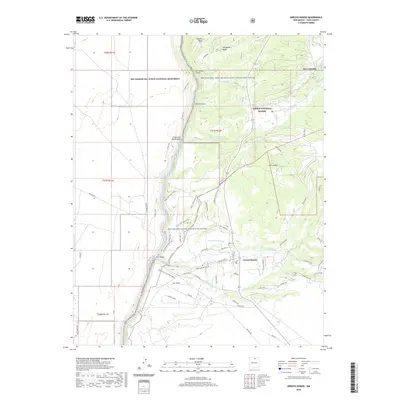
2020 Map of Arroyo Hondo
USGS Topo · Published 2020About this map
The deep gorge of the Rio Grande dominates this Taos County landscape, where the Rio Grande del Norte National Monument and the Rio Grande Wild and Scenic River preserve a striking corridor of volcanic geology and riparian ecology. Along the eastern shelf, the settlements of San Cristobal and Arroyo Hondo maintain a traditional agricultural character through centuries-old irrigation systems like the Acequia de Atalaya and the Llano Ditch. Local history is deeply etched into the terrain, from the Rael Cem near the river bluffs to the thermal waters of Manby Hot Springs. Access to the river's edge is provided by historical crossings like the Dunn Bridge, while a network of paths including the Horse Thief Mesa Trail, Miners Trail, and W Rim Trail traces the edge of the basalt plateaus and canyons.
Find a feature on this map
60 named features on this map. Tap any name to fly to it.
Don’t see what you’re looking for? This feature index may not catch every label — zoom into the map to look around manually.
Map Details
Editions of this 2020 Arroyo Hondo Map
This is the sole edition of this map. No revisions or reprints were ever made.
Other maps of this area

1954 · Raton
USGS Topo · 1:250,000

1958 · Raton
USGS Topo · 1:250,000

1961 · Tres Orejas
USGS Topo · 1:24,000

1963 · Arroyo Seco
USGS Topo · 1:24,000

1963 · Arroyo Hondo
USGS Topo · 1:24,000

1963 · Tres Piedras NE
USGS Topo · 1:24,000

1963 · Cerro De Los Taoses
USGS Topo · 1:24,000

1963 · Questa
USGS Topo · 1:24,000

1963 · Guadalupe Mountain
USGS Topo · 1:24,000

1964 · Los Cordovas
USGS Topo · 1:24,000