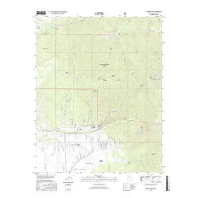
2017 Map of Arroyo Seco
USGS Topo · Published 2017About this map
Taos Pueblo and the surrounding high-desert landscape are central to this 2017 survey of northern New Mexico. The transition from the alluvial valley floor to the soaring peaks of the Taos Mountains is marked by a complex system of water management, including the Rio Lucero Diversion, Tenorio Ditch, and Arroyo Seco Ditch. These traditional irrigation features underpin the agricultural viability of settlements like Arroyo Seco and Valdez, where homes and farms cluster along the life-giving Rio Hondo.
Find a feature on this map
81 named features on this map. Tap any name to fly to it.
Don’t see what you’re looking for? This feature index may not catch every label — zoom into the map to look around manually.
Map Details
Editions of this 2017 Arroyo Seco Map
This is the sole edition of this map. No revisions or reprints were ever made.
Other maps of this area

1954 · Raton
USGS Topo · 1:250,000

1958 · Raton
USGS Topo · 1:250,000

1963 · Wheeler Peak
USGS Topo · 1:24,000

1963 · Arroyo Seco
USGS Topo · 1:24,000

1963 · Arroyo Hondo
USGS Topo · 1:24,000

1963 · Questa
USGS Topo · 1:24,000

1963 · Guadalupe Mountain
USGS Topo · 1:24,000

1963 · Red River
USGS Topo · 1:24,000

1964 · Los Cordovas
USGS Topo · 1:24,000

1964 · Taos
USGS Topo · 1:24,000