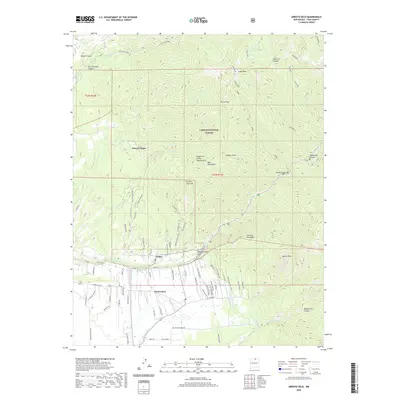
2020 Map of Arroyo Seco
USGS Topo · Published 2020About this map
The mountain settlements of Valdez and Arroyo Seco sit at the base of the high Sangre de Cristo Mountains, where the agricultural heritage of Taos County is visible through a complex network of traditional water management. The map documents vital irrigation infrastructure, including the Rio Lucero Diversion, Arroyo Seco Ditch, and Tenorio Ditch, which channel water from the peaks to the valley floor. Much of the northern terrain is dominated by the Carson National Forest, containing high-altitude landmarks such as Lobo Peak and Perra Peak. The transition from the steep wilderness of Hondo Canyon and San Cristobal Canyon to the residential areas along Gallina Rd and Rte Du Soleil illustrates the unique settlement pattern of the region, where narrow canyons open into fertile basins supported by the Rio Hondo and Arroyo Seco watercourses.
Find a feature on this map
119 named features on this map. Tap any name to fly to it.
Don’t see what you’re looking for? This feature index may not catch every label — zoom into the map to look around manually.
Map Details
Editions of this 2020 Arroyo Seco Map
This is the sole edition of this map. No revisions or reprints were ever made.
Other maps of this area

1954 · Raton
USGS Topo · 1:250,000

1958 · Raton
USGS Topo · 1:250,000

1963 · Wheeler Peak
USGS Topo · 1:24,000

1963 · Arroyo Seco
USGS Topo · 1:24,000

1963 · Arroyo Hondo
USGS Topo · 1:24,000

1963 · Questa
USGS Topo · 1:24,000

1963 · Guadalupe Mountain
USGS Topo · 1:24,000

1963 · Red River
USGS Topo · 1:24,000

1964 · Los Cordovas
USGS Topo · 1:24,000

1964 · Taos
USGS Topo · 1:24,000