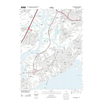
2013 Map of Arthur Kill
USGS Topo · Published 2013About this map
Arthur Kill defines the western edge of Staten Island in this early 21st-century record, separating the borough from the industrial corridors of New Jersey. The landscape is a dense mixture of residential neighborhoods like Great Kills, Rossville, and Eltingville alongside massive topographical features such as the Fresh Kills Landfill. This area is particularly significant for genealogical research, containing a high density of burial grounds including Baron Hirsch Cem, United Hebrew Cem, and Mt Richmond Cem.
Find a feature on this map
82 named features on this map. Tap any name to fly to it.
Don’t see what you’re looking for? This feature index may not catch every label — zoom into the map to look around manually.
Map Details
Editions of this 2013 Arthur Kill Map
This is the sole edition of this map. No revisions or reprints were ever made.
Other maps of this area

1888 · Plainfield
USGS Topo · 1:62,500

1888 · New Brunswick
USGS Topo · 1:62,500

1888 · Sandy Hook
USGS Topo · 1:62,500

1893 · New Brunswick
USGS Topo · 1:62,500

1893 · Plainfield
USGS Topo · 1:62,500

1893 · Sandy Hook
USGS Topo · 1:62,500

1898 · Plainfield
USGS Topo · 1:62,500

1898 · Staten Island
USGS Topo · 1:62,500

1900 · Passaic
USGS Topo · 1:125,000

1900 · Staten Island
USGS Topo · 1:62,500