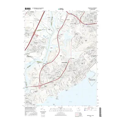
2016 Map of Arthur Kill
USGS Topo · Published 2016About this map
Staten Island’s western and southern reaches are defined here by a dense network of suburban development and industrial shoreline along the Arthur Kill. The map shows a complex landscape where residential neighborhoods like Eltingville, Annadale, and Huguenot meet significant open spaces and historical sites. The southern tip at Tottenville and the coastal stretches of Princes Bay contrast with the heavy industrial infrastructure near Chelsea and the Island of Meadows. Genealogists will find this sheet particularly valuable for its documentation of numerous burial grounds, including the historic Sleight Family Graveyard and several large denominational sites like United Hebrew Cem and Saint Josephs Cem. The presence of the CUNY Coll of Staten Island and the path of the Staten Island Railroad illustrate the borough's modern connectivity, while the edges of the Gateway National Recreation Area at Crookes Point mark the transition to the Atlantic shoreline.
Find a feature on this map
104 named features on this map. Tap any name to fly to it.
Don’t see what you’re looking for? This feature index may not catch every label — zoom into the map to look around manually.
Map Details
Editions of this 2016 Arthur Kill Map
This is the sole edition of this map. No revisions or reprints were ever made.
Other maps of this area

1888 · Plainfield
USGS Topo · 1:62,500

1888 · New Brunswick
USGS Topo · 1:62,500

1888 · Sandy Hook
USGS Topo · 1:62,500

1893 · New Brunswick
USGS Topo · 1:62,500

1893 · Plainfield
USGS Topo · 1:62,500

1893 · Sandy Hook
USGS Topo · 1:62,500

1898 · Plainfield
USGS Topo · 1:62,500

1898 · Staten Island
USGS Topo · 1:62,500

1900 · Passaic
USGS Topo · 1:125,000

1900 · Staten Island
USGS Topo · 1:62,500