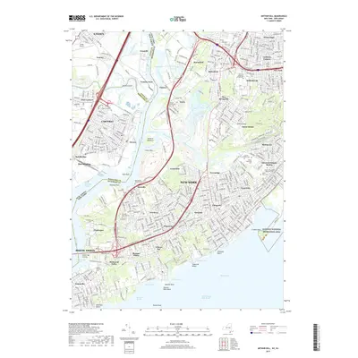
2019 Map of Arthur Kill
USGS Topo · Published 2019About this map
The industrial and maritime corridors of the Arthur Kill define this 2019 survey, showcasing the complex interface between Staten Island, New York, and the New Jersey shoreline. The map documents the dense residential neighborhoods of the island's southern and western reaches, including Rossville, Huguenot, and Great Kills, contrasted against the tidal marshlands of Pralls Island and the Island of Meadows. Genealogists will find significant detail in the numerous burial grounds documented, such as the Rossville AME Zion Cem and Saint Lukes Cem in the west, and the sprawling Mount Richmond Cem and Baron Hirsch Cem to the north.
Find a feature on this map
92 named features on this map. Tap any name to fly to it.
Don’t see what you’re looking for? This feature index may not catch every label — zoom into the map to look around manually.
Map Details
Editions of this 2019 Arthur Kill Map
This is the sole edition of this map. No revisions or reprints were ever made.
Other maps of this area

1888 · Plainfield
USGS Topo · 1:62,500

1888 · New Brunswick
USGS Topo · 1:62,500

1888 · Sandy Hook
USGS Topo · 1:62,500

1893 · New Brunswick
USGS Topo · 1:62,500

1893 · Plainfield
USGS Topo · 1:62,500

1893 · Sandy Hook
USGS Topo · 1:62,500

1898 · Plainfield
USGS Topo · 1:62,500

1898 · Staten Island
USGS Topo · 1:62,500

1900 · Passaic
USGS Topo · 1:125,000

1900 · Staten Island
USGS Topo · 1:62,500