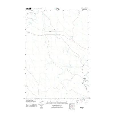
2021 Map of Arvada
USGS Topo · Published 2021About this map
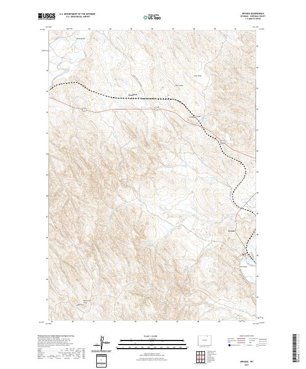
The Powder River carves its way through the southeastern corner of this Sheridan County landscape, where the small settlement of Arvada sits near the junction of S Railway St and Wild Horse Rd. This modern survey illustrates the complex drainage network that defines the region, characterized by a series of deep draws including Scott Draw, Lake Draw, and Hando Draw that lead toward Clear Creek. To the west, the settlement of Kendrick occupies a high point between the creek and the rolling upland terrain.
Find a feature on this map
26 named features on this map. Tap any name to fly to it.
Don’t see what you’re looking for? This feature index may not catch every label — zoom into the map to look around manually.
Map Details
Editions of this 2021 Arvada Map
This is the sole edition of this map. No revisions or reprints were ever made.
Historical Maps of Kendrick Through Time
5 maps found