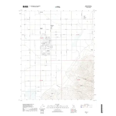
2018 Map of Arvin
USGS Topo · Published 2018About this map
Agricultural development in the southern San Joaquin Valley meets the rising slopes of the Tehachapi Mountains in this detailed 2018 survey. The city of Arvin serves as the primary hub, surrounded by smaller residential clusters such as Edmundson Acres and Mitchells Corner. The landscape is defined by the sharp transition from the grid-patterned fields and irrigation of the Central Valley to the more varied topography of the Tejon Hills. Water management is prominent throughout the lowlands, evidenced by the E Side Canal and seasonal drainage through Tejon Creek. Toward the southeast, the terrain climbs toward Comanche Point, where numerous natural water sources like Amargo Springs, Comanche Spring, and Martina Spring are tucked into the canyons. This map captures the modern footprint of these established valley communities and the surrounding ranchlands.
Find a feature on this map
53 named features on this map. Tap any name to fly to it.
Don’t see what you’re looking for? This feature index may not catch every label — zoom into the map to look around manually.
Map Details
Editions of this 2018 Arvin Map
This is the sole edition of this map. No revisions or reprints were ever made.
Other maps of this area

1914 · Caliente
USGS Topo · 1:125,000

1929 · Bena
USGS Topo · 1:31,680

1929 · Fairfax School
USGS Topo · 1:31,680

1930 · Weed Patch
USGS Topo · 1:31,680

1930 · Bear Mountain
USGS Topo · 1:31,680

1930 · Arvin
USGS Topo · 1:31,680

1931 · West of Tejon Hills
USGS Topo · 1:31,680

1931 · Edison
USGS Topo · 1:31,680

1931 · Tejon Hills
USGS Topo · 1:31,680

1932 · Bena
USGS Topo · 1:31,680