
1930 Map of Bear Mountain
USGS Topo · Published 1930About this map
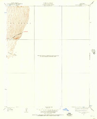
The topography of Kern County in the early 1930s is captured in this advance sheet, focusing on the steep elevations and drainage patterns along the edge of the southern San Joaquin Valley. This specific survey was conducted under State Engineer Edward Hyatt and Governor James Rolph, Jr., emphasizing the collaboration between state and federal agencies to chart the California interior. The map focuses heavily on the prominent Bear Mountain and the adjacent Tejon region, where tightly packed contour intervals illustrate the dramatic rise of the landscape. A single notable thoroughfare, identified simply as the Boulevard, skirts the base of these heights, while drainage features like Sycamore Canyon cut into the slopes. This edition represents a transitional mapping phase, produced before later surveys were consolidated into larger quadrangles.
Find a feature on this map
5 named features on this map. Tap any name to fly to it.
Don’t see what you’re looking for? This feature index may not catch every label — zoom into the map to look around manually.
Map Details
Editions of this 1930 Bear Mountain Map
2 editions found
Other maps of this area

1914 · Caliente
USGS Topo · 1:125,000

1929 · Bena
USGS Topo · 1:31,680

1930 · Arvin
USGS Topo · 1:31,680

1931 · Edison
USGS Topo · 1:31,680

1931 · Tejon Hills
USGS Topo · 1:31,680

1932 · Bena
USGS Topo · 1:31,680

1933 · Arvin
USGS Topo · 1:31,680

1933 · Tejon Hills
USGS Topo · 1:31,680

1933 · Bear Mountain
USGS Topo · 1:31,680

1943 · Cummings Mountain
USGS Topo · 1:62,500