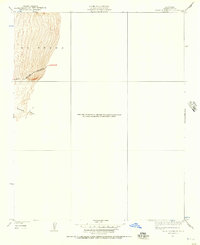
1930 Map of Bear Mountain
USGS Topo · Published 1957About this map
El Tejon dominates the landscape of this partial quadrangle, which focuses on the steep northwestern slopes of the Tehachapi Mountains. Mapped through a 1930 survey by F. H. Purdy, the topography is defined by the sharp descent of Sycamore Canyon toward the valley floor below. A primary point of human infrastructure is the winding route of Bear Mountain Boulevard, which snakes along the contours of the mountain face. This particular sheet is notable for its focus on the northwestern corner of the quadrangle, with much of the remaining area deferred to later mapping efforts. The road pattern and terrain indicate the challenges of early 20th-century travel through this transition between the San Joaquin Valley and the high mountain passes.
Find a feature on this map
4 named features on this map. Tap any name to fly to it.
Don’t see what you’re looking for? This feature index may not catch every label — zoom into the map to look around manually.
Map Details
Editions of this 1930 Bear Mountain Map
2 editions found
Other maps of this area

1914 · Caliente
USGS Topo · 1:125,000

1929 · Bena
USGS Topo · 1:31,680

1930 · Bear Mountain
USGS Topo · 1:31,680

1930 · Arvin
USGS Topo · 1:31,680

1931 · Edison
USGS Topo · 1:31,680

1931 · Tejon Hills
USGS Topo · 1:31,680

1932 · Bena
USGS Topo · 1:31,680

1933 · Arvin
USGS Topo · 1:31,680

1933 · Tejon Hills
USGS Topo · 1:31,680

1933 · Bear Mountain
USGS Topo · 1:31,680