
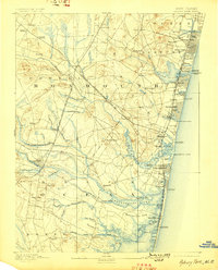
1893 Map of Asbury Park
USGS Topo · Published 1893About this map
Asbury Park and Ocean Grove dominate the northern shoreline on this late nineteenth-century survey, showing the density of these coastal resorts during a period of rapid development. The maritime landscape is defined by the Shark River Inlet, Sea Girt Inlet, and Manasquan Inlet, which are guarded by multiple Life-Saving stations, including L.S. Station Squan Beach and L.S. Station Mantoloking.
Find a feature on this map
98 named features on this map. Tap any name to fly to it.
Don’t see what you’re looking for? This feature index may not catch every label — zoom into the map to look around manually.
Map Details
Editions of this 1893 Asbury Park Map
2 editions found
Other maps of this area

1884 · Whitings
USGS Topo · 1:62,500

1888 · Barnegat
USGS Topo · 1:62,500

1888 · New Brunswick
USGS Topo · 1:62,500

1888 · Asbury Park
USGS Topo · 1:62,500

1888 · Cassville
USGS Topo · 1:62,500

1888 · Sandy Hook
USGS Topo · 1:62,500

1888 · Whitings
USGS Topo · 1:62,500

1893 · New Brunswick
USGS Topo · 1:62,500

1893 · Sandy Hook
USGS Topo · 1:62,500

1893 · Barnegat
USGS Topo · 1:62,500