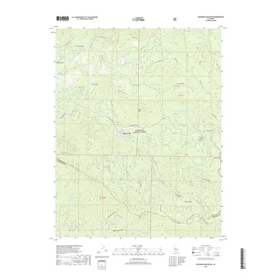
2018 Map of Ascension Mountain
USGS Topo · Published 2018About this map
Harden Flat serves as a central point of activity within the Stanislaus National Forest, where the intersection of Hardin Flat Rd and the historic Big Oak Flat Rd marks a gateway to the high sierra. This 2018 survey illustrates the complex water management infrastructure of the region, notably tracing the Hetch Hetchy Aqueduct as it traverses the Gravel Range near Jones Meadow. The landscape is defined by the deep drainages of the Middle Tuolumne River and the S Fork Tuolumne River, which carve through the high country between peaks like Sawmill Mountain and Ascension Mtn. To the south, the terrain drops toward the N Fork Merced River, with the boundary between Tuolumne and Mariposa counties following the high ground of Pilot Ridge. Historical travel routes such as Old Yosemite Rd and Coulterville Rd remain visible, providing a clear picture of the legacy road network through Crocker Meadow and the Big Creek Basin.
Find a feature on this map
50 named features on this map. Tap any name to fly to it.
Don’t see what you’re looking for? This feature index may not catch every label — zoom into the map to look around manually.
Map Details
Editions of this 2018 Ascension Mountain Map
This is the sole edition of this map. No revisions or reprints were ever made.
Other maps of this area

1893 · Sonora
USGS Topo · 1:125,000

1896 · Sonora
USGS Topo · 1:125,000

1897 · Sonora
USGS Topo · 1:125,000

1897 · Yosemite
USGS Topo · 1:125,000

1898 · Sonora
USGS Topo · 1:125,000

1900 · Yosemite
USGS Topo · 1:125,000

1903 · Yosemite
USGS Topo · 1:125,000

1909 · Yosemite
USGS Topo · 1:125,000

1947 · El Portal
USGS Topo · 1:24,000

1947 · San Jose
USGS Topo · 1:250,000