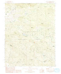
1990 Map of Ascension Mountain
USGS Topo · Published 1990About this map
The confluence of the Middle Fork Tuolumne River and the South Fork Tuolumne River anchors this high-elevation landscape within the Stanislaus National Forest. The map documents a rugged infrastructure network, notably the underground path of the Hetch Hetchy Aqueduct (Tunnel) cutting through the northern peaks near Jones Meadow. In the central valley, the small settlement of Harden Flat serves as a transition point for visitors to the Berkeley-Tuolumne Campground and those traveling via Harden Flat Road.
Find a feature on this map
31 named features on this map. Tap any name to fly to it.
Don’t see what you’re looking for? This feature index may not catch every label — zoom into the map to look around manually.
Map Details
Editions of this 1990 Ascension Mountain Map
This is the sole edition of this map. No revisions or reprints were ever made.
Other maps of this area

1893 · Sonora
USGS Topo · 1:125,000

1896 · Sonora
USGS Topo · 1:125,000

1897 · Sonora
USGS Topo · 1:125,000

1897 · Yosemite
USGS Topo · 1:125,000

1898 · Sonora
USGS Topo · 1:125,000

1900 · Yosemite
USGS Topo · 1:125,000

1903 · Yosemite
USGS Topo · 1:125,000

1909 · Yosemite
USGS Topo · 1:125,000

1947 · El Portal
USGS Topo · 1:24,000

1947 · San Jose
USGS Topo · 1:250,000