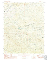
1992 Map of Ascension Mountain
USGS Topo · Published 1995About this map
The Middle Tuolumne River and South Fork Tuolumne River carve through this section of the Stanislaus National Forest during the late twentieth century. This landscape is defined by its infrastructure and logging history, notably the path of the Hetch Hetchy Aqueduct (Tunnel) and an Old RR Grade winding through the south. The terrain transitions into the high country toward Yosemite National Park at the eastern edge.
Find a feature on this map
32 named features on this map. Tap any name to fly to it.
Don’t see what you’re looking for? This feature index may not catch every label — zoom into the map to look around manually.
Map Details
Editions of this 1992 Ascension Mountain Map
This is the sole edition of this map. No revisions or reprints were ever made.
Other maps of this area

1893 · Sonora
USGS Topo · 1:125,000

1896 · Sonora
USGS Topo · 1:125,000

1897 · Sonora
USGS Topo · 1:125,000

1897 · Yosemite
USGS Topo · 1:125,000

1898 · Sonora
USGS Topo · 1:125,000

1900 · Yosemite
USGS Topo · 1:125,000

1903 · Yosemite
USGS Topo · 1:125,000

1909 · Yosemite
USGS Topo · 1:125,000

1947 · El Portal
USGS Topo · 1:24,000

1947 · San Jose
USGS Topo · 1:250,000