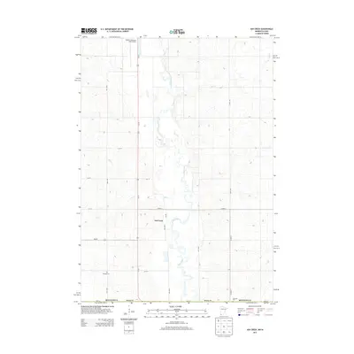
2013 Map of Ash Creek
USGS Topo · Published 2013About this map
The Rock River meanders south through the undulating prairie landscape of the Minnesota and Iowa borderlands, anchoring a region defined by its agricultural grid and dispersed rural settlements. In the southwestern corner, the small community of Ash Creek sits near the junction of Us-75 and MN-270, serving as a focal point for the surrounding farmsteads. The land is drained by smaller tributaries including Ash Cr and Elk Cr, which carve gentle draws into the terrain.
Find a feature on this map
23 named features on this map. Tap any name to fly to it.
Don’t see what you’re looking for? This feature index may not catch every label — zoom into the map to look around manually.
Map Details
Editions of this 2013 Ash Creek Map
This is the sole edition of this map. No revisions or reprints were ever made.
Other maps of this area

1955 · Sioux Falls
USGS Topo · 1:250,000

1958 · Sioux Falls
USGS Topo · 1:250,000

1967 · Magnolia
USGS Topo · 1:24,000

1967 · Hills
USGS Topo · 1:24,000

1967 · Hills NE
USGS Topo · 1:24,000

1967 · Ellsworth
USGS Topo · 1:24,000

1967 · Ash Creek
USGS Topo · 1:24,000
1967 · Luverne
USGS Topo · 1:24,000

1971 · Edna
USGS Topo · 1:24,000

1971 · Lester
USGS Topo · 1:24,000