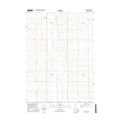
2016 Map of Ash Creek
USGS Topo · Published 2016About this map
The Rock River meanders southward through this rural borderland, crossing from Minnesota into Iowa amidst a grid of section lines and gravel roads. This 2016 survey documents the agricultural landscape of Rock County and Lyon County, where the terrain is punctuated by small tributaries like Ash Creek and Elk Cr. The mapping reflects a region defined by its long-standing farming infrastructure, with a systematic network of numbered avenues and streets providing access to isolated farmsteads.
Find a feature on this map
38 named features on this map. Tap any name to fly to it.
Don’t see what you’re looking for? This feature index may not catch every label — zoom into the map to look around manually.
Map Details
Editions of this 2016 Ash Creek Map
This is the sole edition of this map. No revisions or reprints were ever made.
Other maps of this area

1955 · Sioux Falls
USGS Topo · 1:250,000

1958 · Sioux Falls
USGS Topo · 1:250,000

1967 · Magnolia
USGS Topo · 1:24,000

1967 · Hills
USGS Topo · 1:24,000

1967 · Hills NE
USGS Topo · 1:24,000

1967 · Ellsworth
USGS Topo · 1:24,000

1967 · Ash Creek
USGS Topo · 1:24,000
1967 · Luverne
USGS Topo · 1:24,000

1971 · Edna
USGS Topo · 1:24,000

1971 · Lester
USGS Topo · 1:24,000