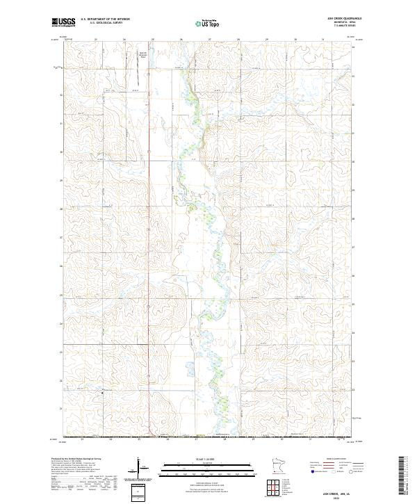
2022 Map of Ash Creek
USGS Topo · Published 2022About this map
Rock River meanders southward through the center of this Rock County landscape, joined by its tributaries Ash Cr and Elk Cr. The region is defined by its rectilinear grid of section-line roads, including Co Hwy 16 and Co Hwy 15, which serve the expansive agricultural tracts typical of southwestern Minnesota. Near the northern boundary, Quentin Aanenson Field stands as a notable landmark alongside the drainage basins. Local history is anchored by the presence of Eastside Cem and Ebenezer Cem, situated near the southern border where the state line meets Iowa. The land division remains strictly organized by the Public Land Survey System, with townships such as t102n r45w and t101n r44w providing the structural framework for the rural farmsteads and infrastructure of the early 21st century.
Find a feature on this map
36 named features on this map. Tap any name to fly to it.
Don’t see what you’re looking for? This feature index may not catch every label — zoom into the map to look around manually.
Map Details
Editions of this 2022 Ash Creek Map
This is the sole edition of this map. No revisions or reprints were ever made.
Other maps of this area

1955 · Sioux Falls
USGS Topo · 1:250,000

1958 · Sioux Falls
USGS Topo · 1:250,000

1967 · Magnolia
USGS Topo · 1:24,000

1967 · Hills
USGS Topo · 1:24,000

1967 · Hills NE
USGS Topo · 1:24,000

1967 · Ellsworth
USGS Topo · 1:24,000

1967 · Ash Creek
USGS Topo · 1:24,000
1967 · Luverne
USGS Topo · 1:24,000

1971 · Edna
USGS Topo · 1:24,000

1971 · Lester
USGS Topo · 1:24,000