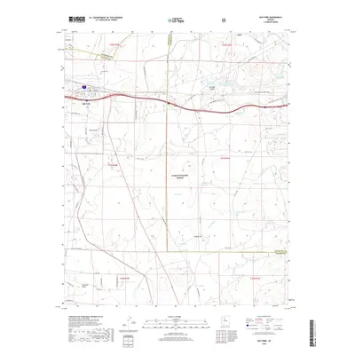
2018 Map of Ash Fork
USGS Topo · Published 2018About this map
Ash Fork serves as the central hub of this northern Arizona landscape, where the legacy of early western infrastructure is visible through a complex network of water management and transportation. The community is flanked by significant technical landmarks like the Steel Dam Reservoir and the Masonry Number Two Reservoir near Johnson Canyon, reflecting the critical need for water storage in this high-desert environment. Much of the surrounding area is protected within the Kaibab National Forest, marked by distinctive terrain such as Big Black Mesa and Putney Flat. For those tracing local history or family ties, the Ash Fork Cem and numerous named water tanks, including Rods Winter Camp Tank and Hells Uncle Tank, provide specific points of reference for ranching and settlement patterns. Modern transit routes like Old Rte 66 and the Ash Fork Hill Mtn. Bike trail cross the same corridors once carved by the railroad and early pioneers.
Find a feature on this map
63 named features on this map. Tap any name to fly to it.
Don’t see what you’re looking for? This feature index may not catch every label — zoom into the map to look around manually.
Map Details
Editions of this 2018 Ash Fork Map
This is the sole edition of this map. No revisions or reprints were ever made.
Other maps of this area

1886 · Chino
USGS Topo · 1:250,000

1891 · Chino
USGS Topo · 1:250,000

1922 · Williams
USGS Topo · 1:125,000

1947 · Ash Fork
USGS Topo · 1:62,500

1947 · Picacho Butte
USGS Topo · 1:62,500

1948 · Ash Fork
USGS Topo · 1:63,360

1948 · Williams
USGS Topo · 1:250,000

1948 · Picacho Butte
USGS Topo · 1:63,360

1949 · Ash Fork
USGS Topo · 1:62,500

1950 · Picacho Butte
USGS Topo · 1:62,500