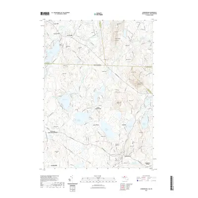
2021 Map of Ashburnham
USGS Topo · Published 2021About this map
Ashburnham and the surrounding Worcester County highlands are defined by a complex network of glacial lakes and industrial history. The landscape is dotted with early settlements like Converseville, Lane Village, and Blackburn Village, many of which developed around water-driven sites such as Factory Village Pond. This survey shows the region's topographical transition across the state line into New Hampshire, where the Wapack Range rises prominently with peaks like Pratt Mtn and Mt Watatic. Local history is anchored by several burial grounds, including Fairbanks Cem and Saint Denis Cem, alongside traces of former transit corridors like the Old North Ashburnham Station. From the shores of Lake Monomonac to the wooded slopes of Little Watatic Mtn, the map documents a community where residential expansion and traditional rural land use intersect amidst the headwaters of the Millers River.
Find a feature on this map
79 named features on this map. Tap any name to fly to it.
Don’t see what you’re looking for? This feature index may not catch every label — zoom into the map to look around manually.
Map Details
Editions of this 2021 Ashburnham Map
This is the sole edition of this map. No revisions or reprints were ever made.
Other maps of this area

1887 · Winchendon
USGS Topo · 1:62,500

1887 · Fitchburg
USGS Topo · 1:62,500

1889 · Fitchburg
USGS Topo · 1:62,500

1890 · Winchendon
USGS Topo · 1:62,500

1893 · Fitchburg
USGS Topo · 1:62,500

1894 · Winchendon
USGS Topo · 1:62,500

1898 · Monadnock
USGS Topo · 1:62,500

1900 · Peterboro
USGS Topo · 1:62,500

1931 · Fitchburg
USGS Topo · 1:48,000

1932 · Winchendon
USGS Topo · 1:48,000